Traffic Engineering

Axiom traffic group leading various strategic projects by insisting on the definition of transportation planning which is defined as planning required in the operation, provision and management of facilities and services for the modes of transport to achieve safer, faster, comfortable, convenient, economical and environment-friendly movement of people and goods, hope to make an effective role in gulf area.

...

Khasab-Qeshm shipping line study (NFC)

Standard forms were prepared and the cons and pros were evaluated for different options of shipping line services.
...

...

Feasibility Study of online Simulation of Highways in Tehran

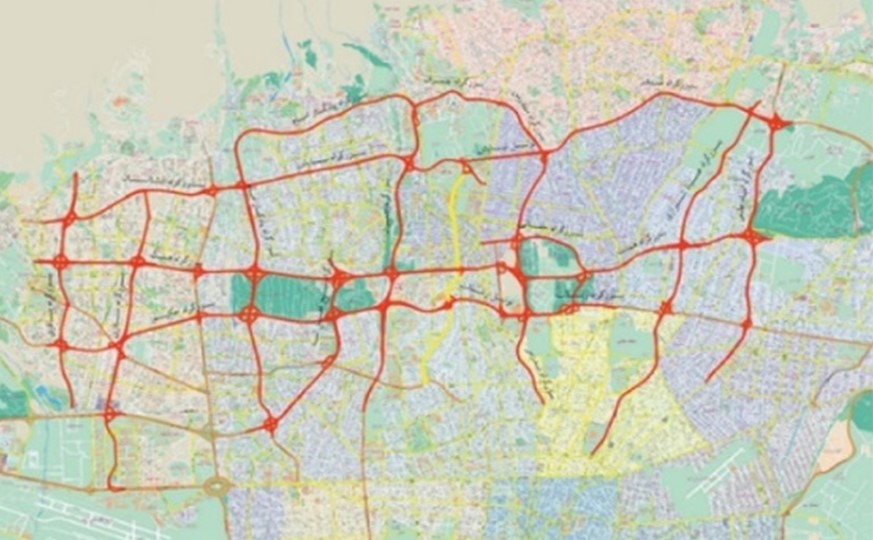
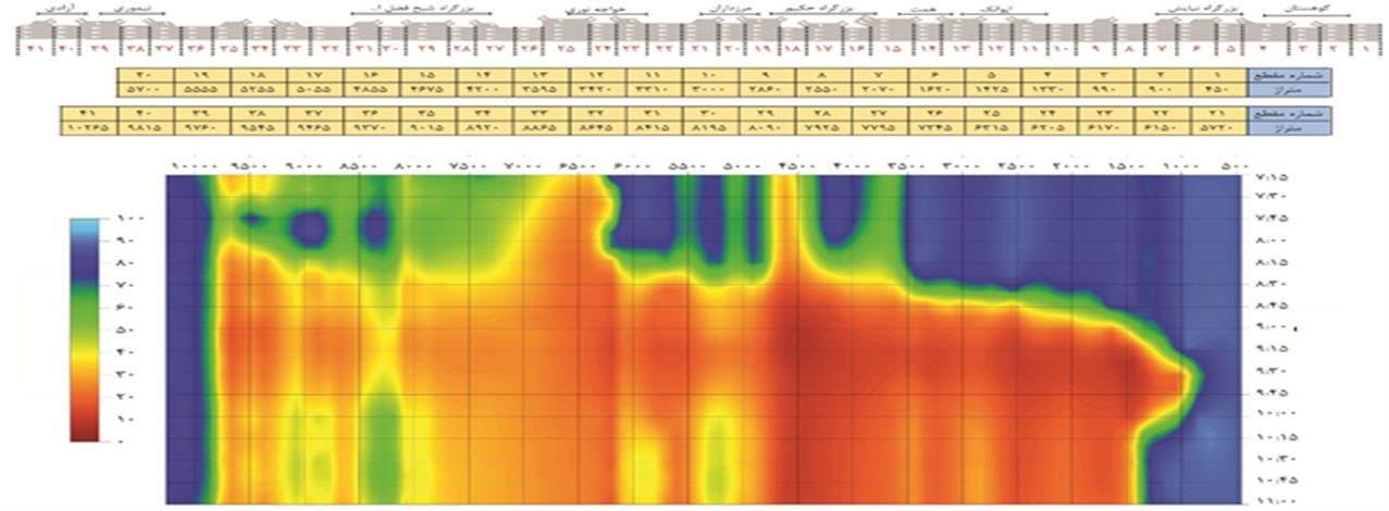
In this project, 13 main highways were investigated. For this study, online simulation was adopted, the real time traffic data and changes in traffic flow were combined in order to predict the rate of traffic increase. The project goal was to assess highway capacity and develop efficient traffic management strategy for the urban road network.
Project Objectives
  • Develop simulation models for the highway network and create a virtual environment to assess different solutions of traffic management system
  • Feasibility study of real-time simulation of highway network in Tehran
  • Review of the other countries experience in the field of large-scale real-time simulation of highways
  • Highlight the advantages and applications of real-time simulation
  • Define the required information and infrastructure for online simulation of freeways

...

...

Highway Management Study in Shahran-Damavand Corridor

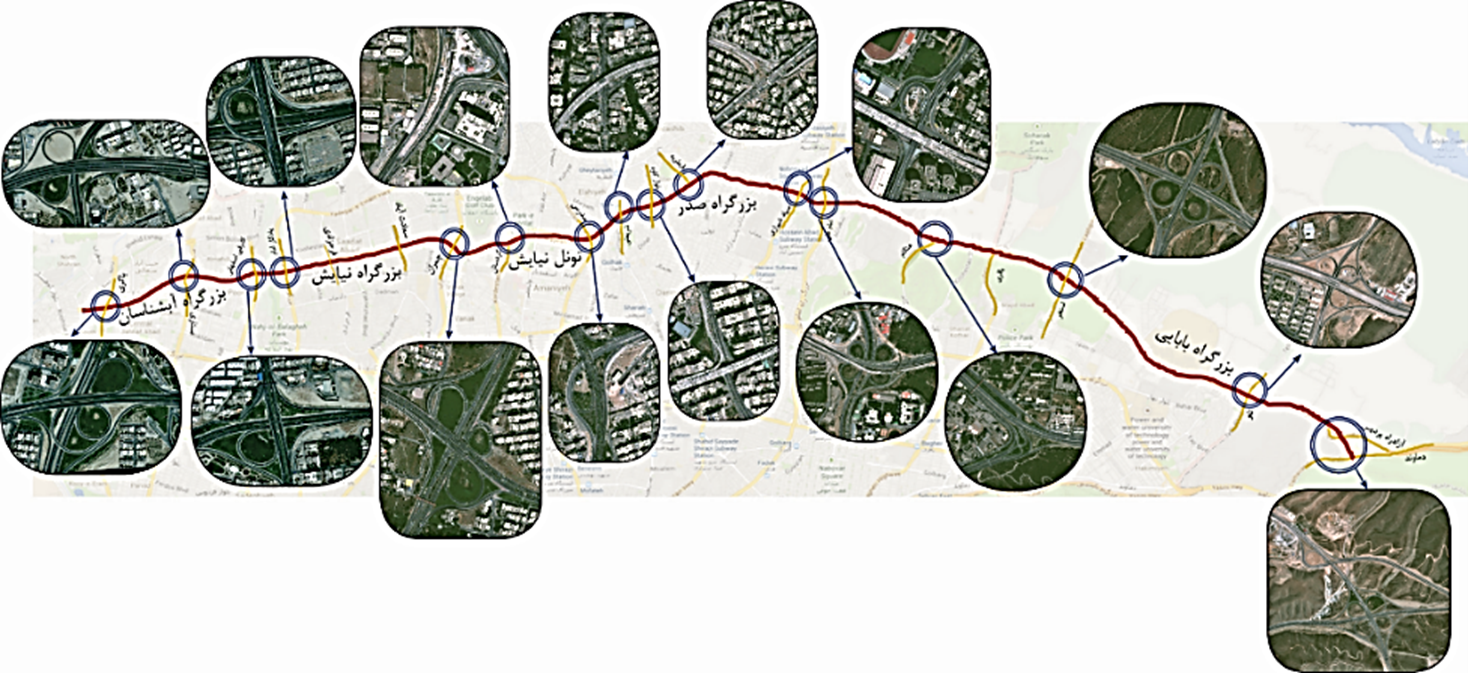
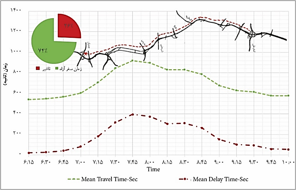
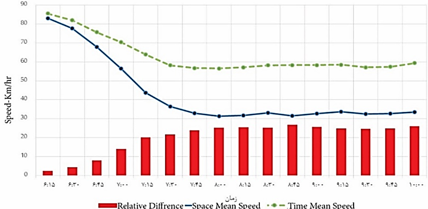
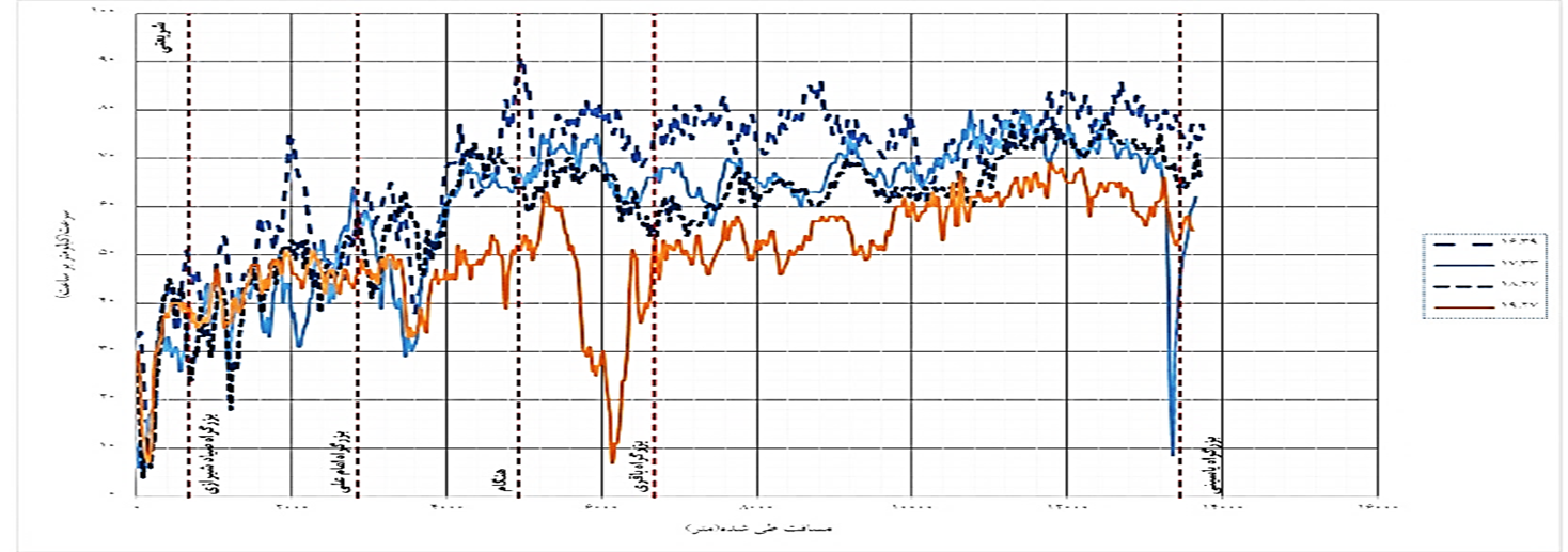
The east-west Shahran-Damavand corridor connects Sadr-Niyayesh tunnel and Sadr multi-level bridge in North of Tehran. The highway carries high volume of traffic. A highway management programme was needed to monitor and control the vehicle congestion, and to improve the road safety. This project was awarded to review the existing condition and investigate possible traffic management solutions for this highway using traffic simulation modelling.
Project Objectives
  • Assess and analyze the existing conditions using the level of service analysis based on HCM 2010
  • Develop simulation models for existing condition using Aimsun and identify the bottlenecks and traffic delays as well as the effects of critical intersections on traffic operational indices
  • Suggest practical solutions for highways operation and test the suggested solutions using simulation software
  • Simulate the probable scenarios in case of incidence occurrence and evaluate the traffic operational indices
  • To design a spatial database for the highway under study in a GIS environment

...

...

Study of Road Highway Management in Hemmat Corridor, Tehran

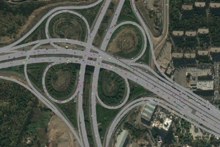
Hemmat Highway corridor was designed and completed to connect Yasini Highway in the east to Kharazi highway in the west. Hemmat corridor is about 41km long connecting Damavand to Karaj. This highway carries probably the highest traffic volumes compared with other highways. The most critical area along this highway which causes heavy traffic jam is the entry ramp from Modares Highway mainly due to the variation in carriageway width. It was decided to carry out a study of this highway and try to find practical solutions for efficient traffic management.

Project Objectives
  • Assess and analyze the existing conditions using the level of service analysis based on HCM 2010
  • Develop simulation models for existing condition using Aimsun and identify the bottlenecks and traffic delays as well as the effects of critical intersections on traffic operational indices
  • Suggest practical solutions for highways operation and test the suggested solutions using simulation software
  • Simulate the probable scenarios in case of incidence occurrence and evaluate the traffic operational indices
  • To design a spatial database for the highway under study in a GIS environment

...

...

Traffic Impact Study of Sadr Highway and the new Niyayesh-Sadr Tunnel

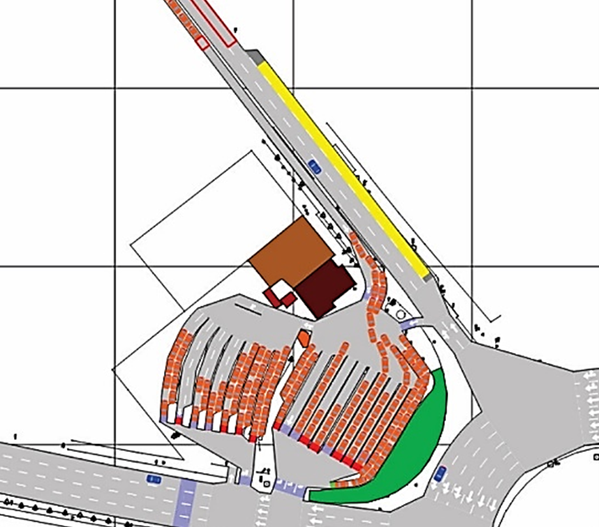
To improve heavy traffic along existing Hemmat and Sadr highways, a new east-west corridor above Sadr highway was planned. This corridor consisted of a bridge over and along Sadr highway from the east to Niyayesh highway and a 11km tunnel under the densely populated part of Tehran. A traffic impact study was required to assess the impact of this new corridor on the overall Tehran highway network. The main purpose of this study was to assess the level of impact, develop practical solutions to improve congestions and delays and to gauge the level of improvements that this corridor would contribute to the overall highway network.
Project Objectives
  • Investigate the operational conditions of Sadr highway and Niyayesh tunnel after construction
  • Conduct a traffic impact study to assess impacts resulting from this scheme over the nearby road network
  • Identify possible bottlenecks
  • Suggest more efficient operational management programme for Sadr multi-level highway and Niyayesh tunnel
  • Suggest efficient operation of nearby road network
  • Develop incident management programme for the new corridor

...

Taxi Regulation Study in Tehran

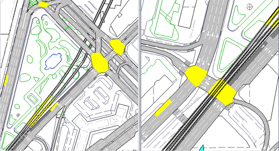
The taxi authority recognized a taxi regulation study in Tehran. Transportation and Traffic Organization of Tehran Municipality appointed the consultant to conduct this study.
Defined Tasks:
  • Study of Niyayesh-Shahran taxi line
  • Study of taxi lines of Niloo-Brazil street
  • Study of taxi lines heading to the east (Region 12 in Tehran)
  • Study taxi lines located in Vanak terminal

...

Calibration of Simulation Software Based on Driver’s Behavior in Tehran, Iran
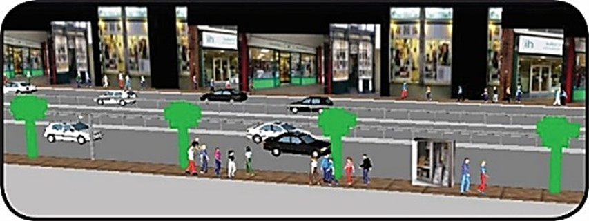
Calibration of Simulation Software Based on Driver’s Behavior in Tehran, Iran
Project Objectives:
  • Improve abilities of existing simulation software and enhance technical awareness of traffic experts in Tehran to precisely determine and evaluate the required parameters for efficient planning of traffic engineering projects in Tehran
  • Select the most adequate software for simulation of Tehran Road network
  • Determine the equivalent vehicle type for simulation process
  • To customize and localize 1) the parameters of car-following models, 2) suitable parameters of lane changing models, 3) parameters of gap acceptance model in Tehran
  • To develop an appropriate framework for data collection, calibration and simulation

...

...

Pedestrian Modelling and Simulation in Tehran

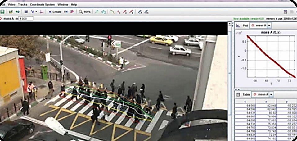
Walking facilities including pavements, walkways, stairways, crosswalks, signalized intersection crossings and signalized intersection crossings in five different locations were recorded on video. Pedestrian trajectories and the required data were extracted from simulation models, and then pedestrian speed and acceleration were calculated. The social force model available in most of simulation software was used to model the pedestrian movements for Tehran pedestrian facilities and conditions.

Project Objectives:
  • Investigate pedestrian behavior in different traffic conditions in Tehran
  • Evaluate parameters relating to different traffic conditions and facilities
  • Determine the pedestrian behavioral parameters which affect the simulation and design of traffic facilities
  • Develop pedestrian behavior models in Tehran
  • Simulate pedestrian behavior using a software close to real situations